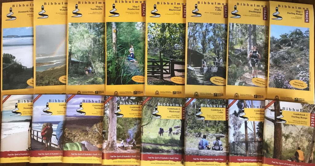
We received our maps for the Bibbulmun Track 🙂
We are starting to explore the first section of the trail, Kalamunda to North Bannister. Here the kids are calculating the distances between camp sites in this section. This initial exploration will start to give us an idea of time needed to complete the track, how much food we will need to carry for each section, and how much money we will need to pay for it all 🙂 So this is the start to understanding how we are going to plan, and budget for this adventure. I am trying to step back, and let them work it out…that’s why we start planning so early…so there is time to learn 🙂
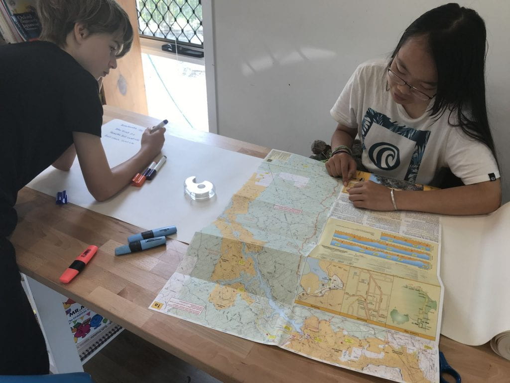
Calculating the distances between campsites of section 1 of the Bibbulmun Track
After writing a list of all the camp names and the distances in section 1 of the track, they started a spreadsheet. We ultimately need this spreadsheet to have every bit of planning and link to a budget spreadsheet, which they are also going to create – so it is a big task 🙂 But we agreed that just ‘starting’ was the best way to a daunting task. As we build the information, the layout, design, colours, adding of sheets, pie charts…can all be a work in progress. Today they learned how to add a formula that calculates the running total of the kms 🙂
-
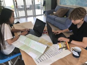
- Starting our Journey Planning Spreadsheet
-
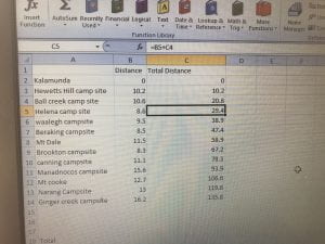
- Entering the distances and formulas for a running total
The first section is a total of 135km, with 12 days of hiking before getting to a town 😱 This means carrying 12 days worth of food 😱 Some hikers ‘double hut’ to shorten the length between towns. We like to be in the moment, and of course have a little time to just ‘be’ in the afternoons. We are not ‘double hut’ kind of peeps 🙂 But…the thought of carrying 12 days worth of food was enough to make the kids use their map skills to study the track a bit closer 🙂 Could we ‘double hut’ on some of the days?
We have been reading a few books from the library about navigation, as we plan to learn how to use a compass on our overnight hikes that we will do over the next few months testing our dehydrated food and gear (and I mean use a compass properly, not just have one with us that we don’t know how to use 😄) This DK book ‘Survival for Beginners‘ was really good to help the kids get a visual of the contour lines.
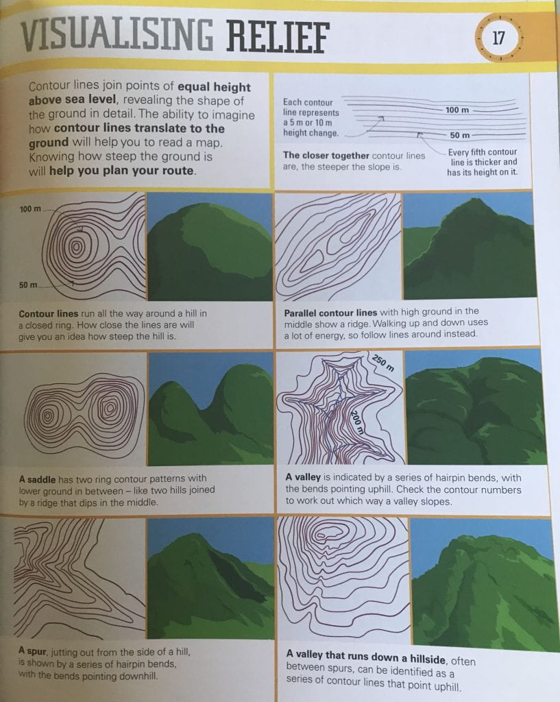
We know from previous hikes, that sometimes a 9km hike can take longer than a 20km hike. Distance alone is not enough to determine which days are possible to ‘double hut’. So the kids then got to studying the section 1 map a little more, studying the contours, and the terrain profiles.
-
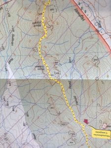
- Looking closely at the contour lines, do we go between valleys or over mountains?
-

- Using the terrain profile to get an idea of the elevation gains between camps
We probably won’t know till we are on the trail what we will do, we will need to be prepared for 12 days in the bush 🙂 But the thought of 12 days without access to food was enough for the kids to study the map a little closer than they would 🙂